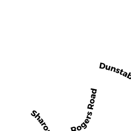
75-77 DUNSTABLE RD
Owner Information
DELUCA CAROLYN J &
75 DUNSTABLE RD
NO CHELMSFORD, MA 01863


Property Details
75-77 DUNSTABLE RD is classified as a Two-Family Residential (Family conver.).
The primary structure on this property was built in 1900. There are 3,735ft2 of built area within this property. There is 2,336ft2 of residential/living space within this property. This property is listed as having 8 rooms.
75-77 DUNSTABLE RD is valued at $424,700. The land is valued at $232,000 and the structures are valued at $184,300. There is an additional valuation of $8,400 on this property.
This property is in Zone RB. Confirm with local Zoning Board authorities to ensure there are no overlays or other easements on this property.
The most recent deed for 75-77 DUNSTABLE RD is recorded at the local registrar in Book 8906, Page 0090. 75-77 DUNSTABLE RD was last sold on Thursday, November 20, 1997 for $186,600.
Assessment data from fiscal year 2022.
Flood Data
This property is partially within the AE Zone (within floodplain). Approximately 1.61 acres (81.36%) of the property is within this zone.
This information is sourced from the FEMA National Flood Hazard Layer. See our full disclamer.
Broadband Internet Providers
| Provider | Type | Bandwidth (mbps) | |
|---|---|---|---|
| Comcast | Cable | 1000 | 35 |
| Viasat Inc | Satellite | 100 | 3 |
| Verizon New England Inc. | DSL | 15 | 1 |
| Verizon New England Inc. | Fiber | 940 | 880 |
| GCI Communication Corp. | Satellite | 0 | 0 |
| HughesNet | Satellite | 25 | 3 |
| VSAT Systems, LLC. | Satellite | 2 | 1 |
Broadband service provider data from December 2020.
Adjacent Properties
- 52 TYNGSBORO RD
Automotive Vehicles Sales and Service owned by DUFFY EDWARD J & EILEEN M - 71 DUNSTABLE RD
Two-Family Residential owned by ROY KAREN J - 83 DUNSTABLE RD
Single Family Residential owned by BELANGER JEFFREY TRUSTEE BELANGER - 95 DUNSTABLE RD
Single Family Residential owned by LY LEANG & - 70-72 TYNGSBORO RD
Two-Family Residential owned by DEMARCO CLAIRE